|
At a glance:
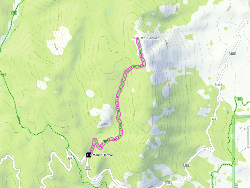
Distance: 1.1 miles one way
Difficulty: Moderate (steep but short) Ascent: 921 ft Map Link: Mount Herman Google Maps Link: Mount Herman Dogs: Yes Bikes: No (But I've seen it) |
Mount Herman
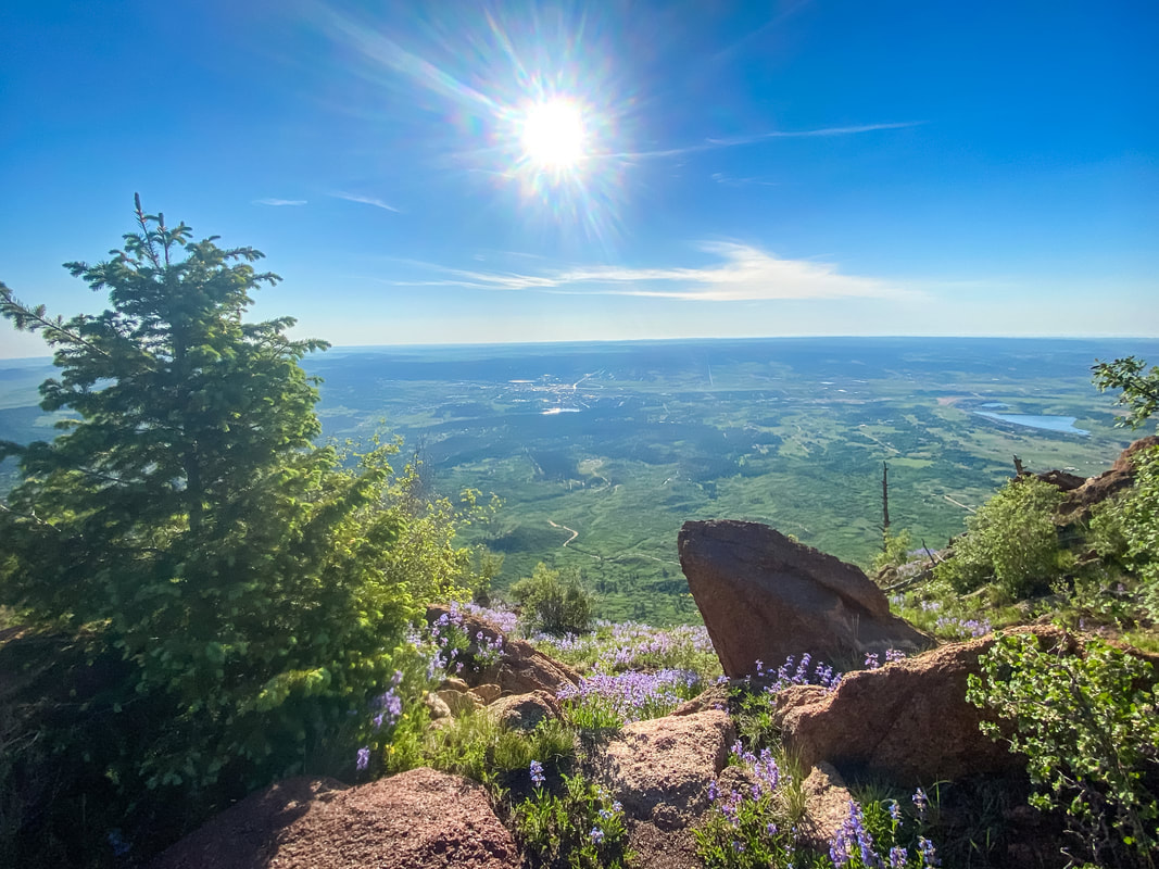
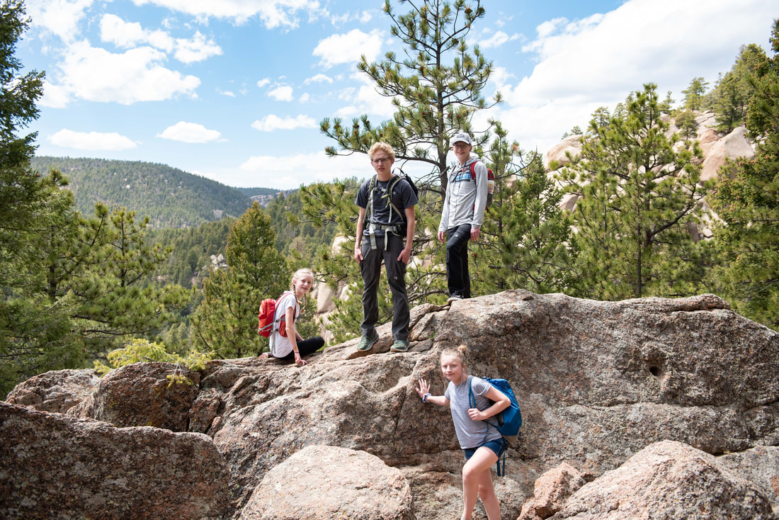
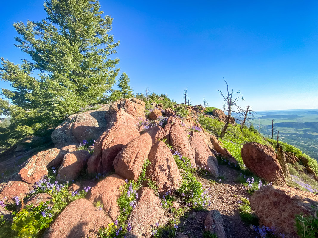
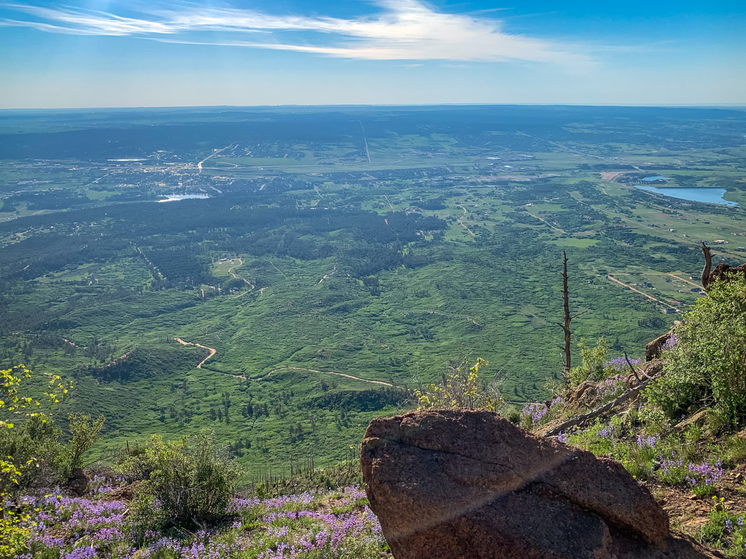
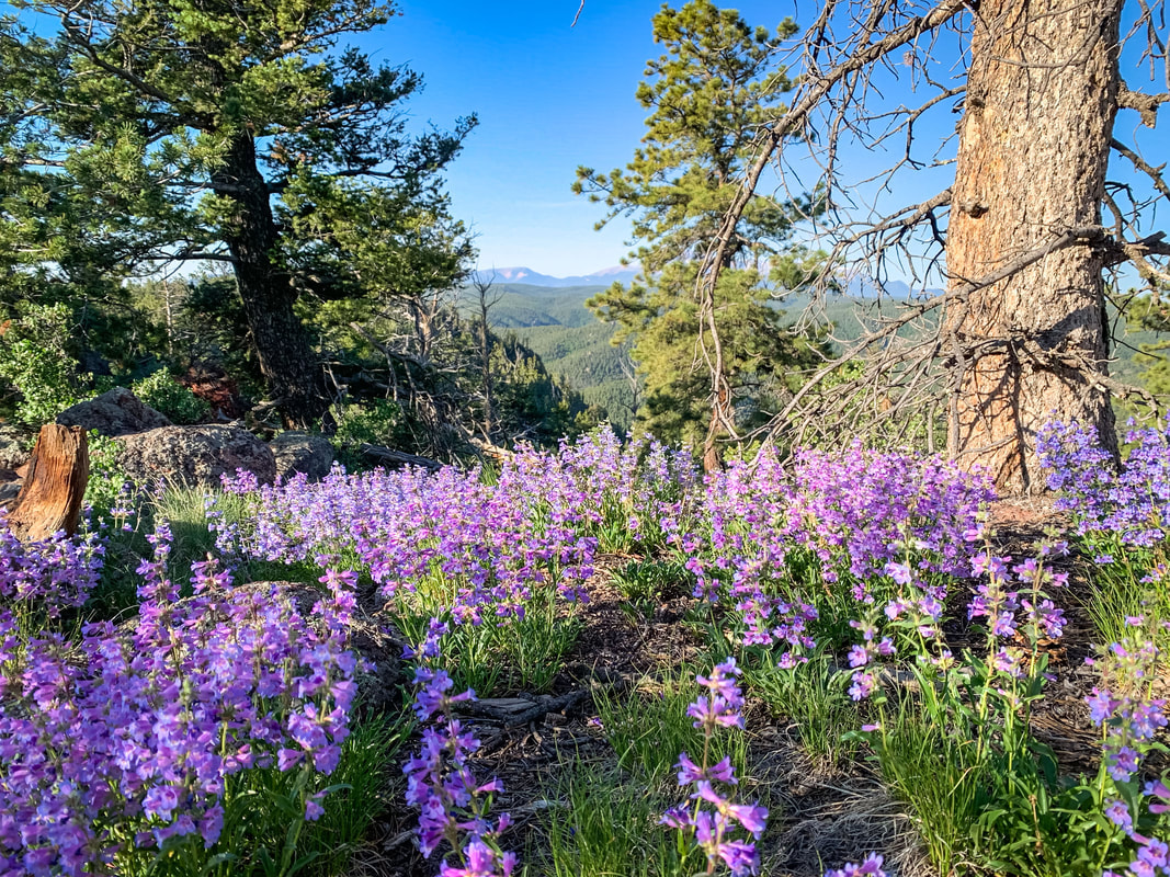
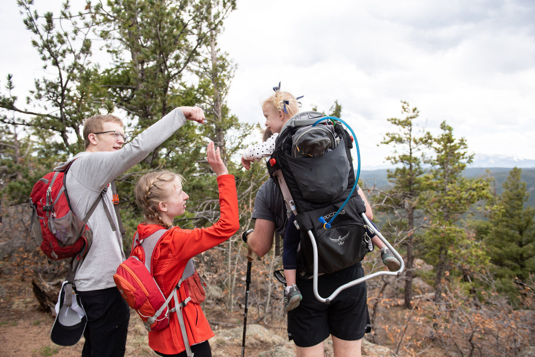
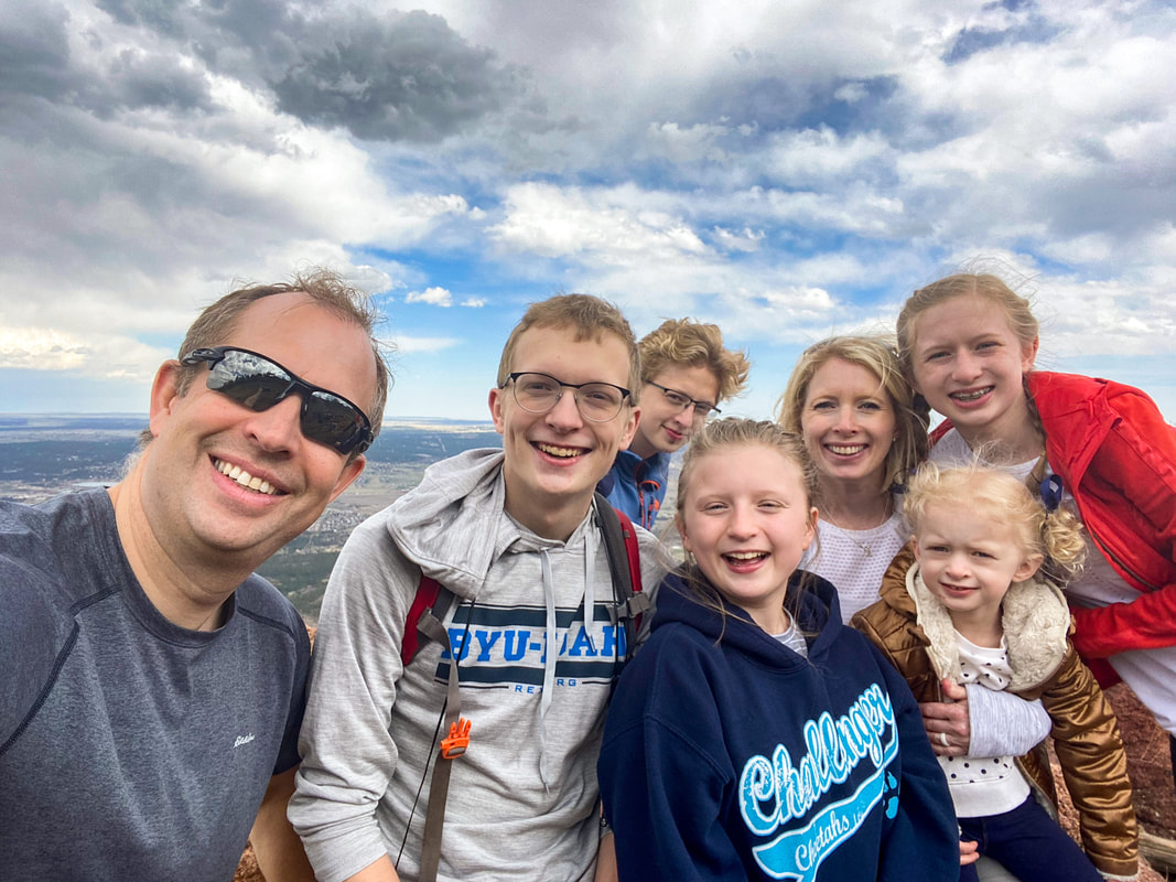
A great quick hike with spectacular views to the East and to the West. It is a typical Colorado steepy, but it is so short, that you don't really notice too much. The road to access this area has become so popular, that it can be a bit crowded on weekends, so we typically go early in the morning on a weekend or later in the afternoon during the week. The summit is a great place to camp for a spectacular sunrise!
|
Mount Herman trail
getting there:
Address: Mt. Herman Trailhead, Colorado Springs, CO 80921
1) From Colorado Springs, head North on I-25 and take exit 161 for CO-105 toward Monument / Palmer Lake.
2) Turn left onto CO-105 W
3) Continue straight on 2nd St. and mind the speed limit.
4) In about 0.7 miles, turn left onto Mitchell Avenue
5) After about 0.6 miles, turn right onto Mt. Herman Road and follow that until it becomes a dirt road and you go up, up, up.
6) The parking lot is pretty small, so it's easy to pass by it or to find it totally full with people parking up the road.
The Hike:
This is a fairly easy hike that starts out steep and then gets pretty darn steep and then levels out at the summit. The views are spectacular and the summit a fun place to explore.
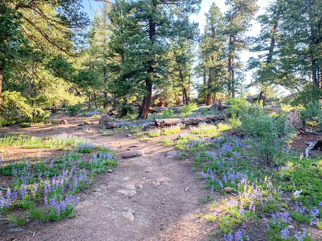
From the parking lot, head up into the forest following along the creek. You will come to a clearing straight ahead, once you see the clearing make a sharp right and start heading up.
The trail will meander through the trees. You will soon head up a steep gravely section that can be a little slippery (especially when you come back down).
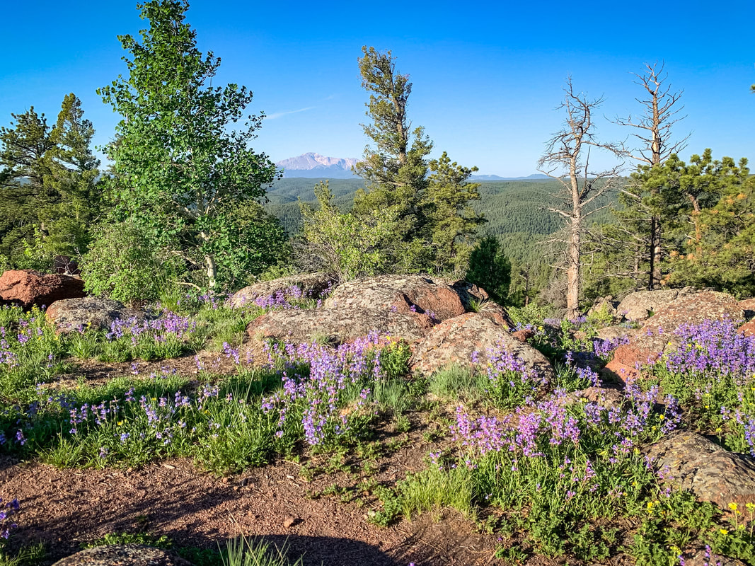
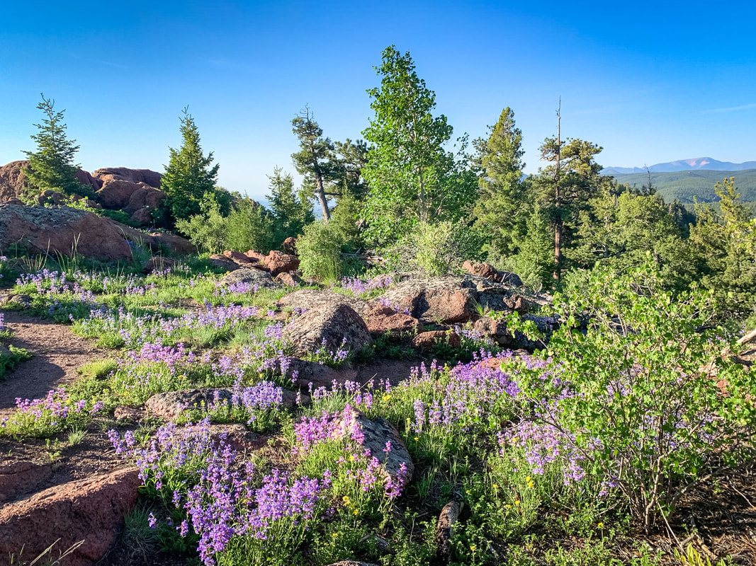
Once you pass this steep part, you will find yourself with some options to zig zag up through some rocks to the saddle. Once you gain the saddle, you'll get a great view to the East, you can pretty much just head North (left). There are multiple possible trails to follow, we usually follow the one on the west side of the summit. The views to the East are better, but you will have to climb your way to the summit over some washed out trail.
Enjoy the views and explore to your heart's content!
From the parking lot, head up into the forest following along the creek. You will come to a clearing straight ahead, once you see the clearing make a sharp right and start heading up.
The trail will meander through the trees. You will soon head up a steep gravely section that can be a little slippery (especially when you come back down).
Once you pass this steep part, you will find yourself with some options to zig zag up through some rocks to the saddle. Once you gain the saddle, you'll get a great view to the East, you can pretty much just head North (left). There are multiple possible trails to follow, we usually follow the one on the west side of the summit. The views to the East are better, but you will have to climb your way to the summit over some washed out trail.
Enjoy the views and explore to your heart's content!