|
At a glance:
Distance: 6.75 miles roundtrip
Difficulty: Class 1 Ascent: 3,450 feet Map Link: Quandary Peak Website: 14ers.com Quandary Peak Google Maps Link: Quandary Peak Dogs: On a leash |
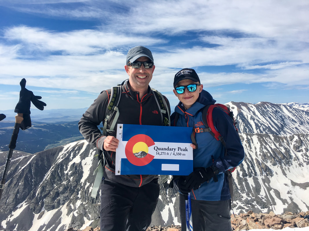
Quandary Peak
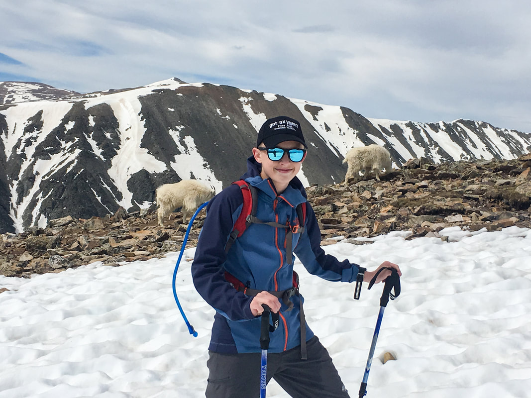
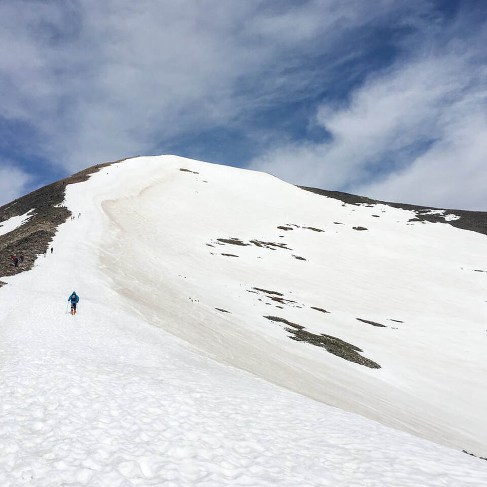
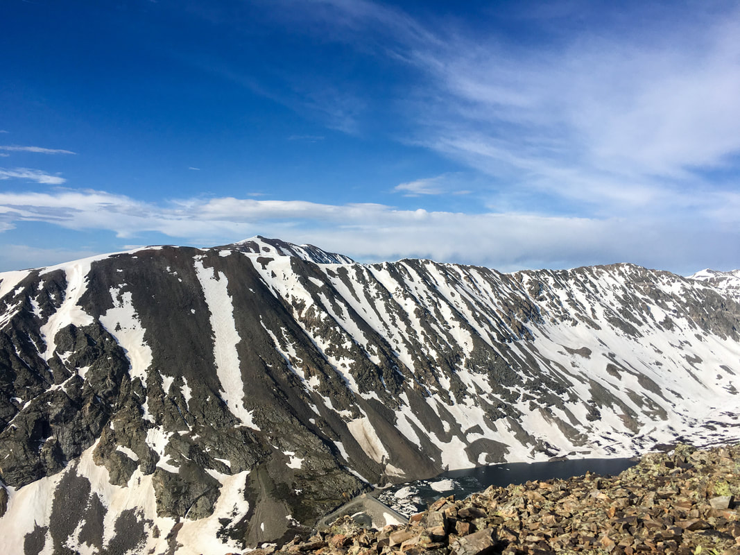
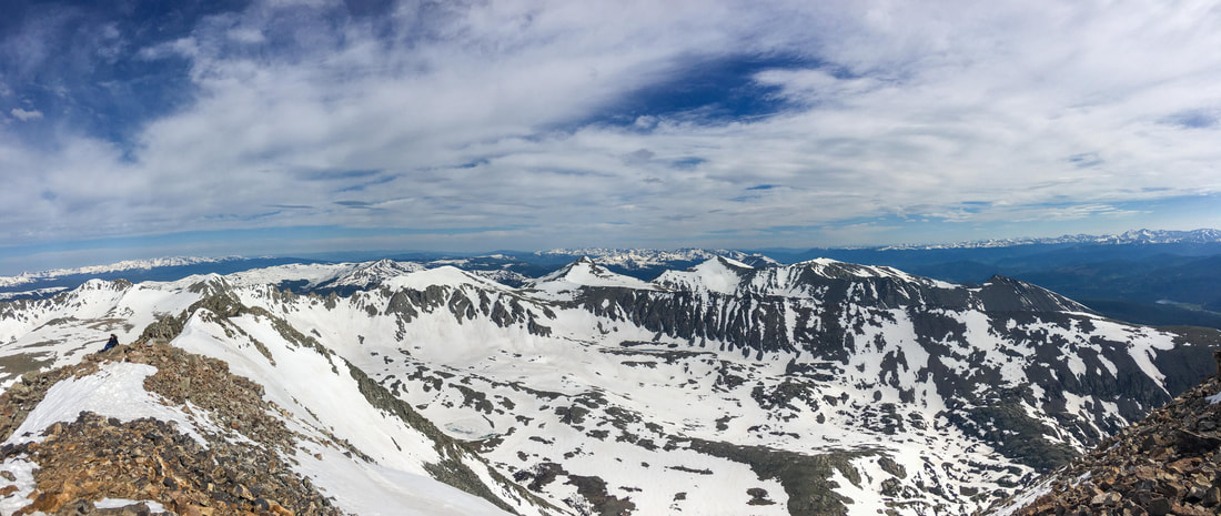
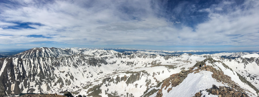
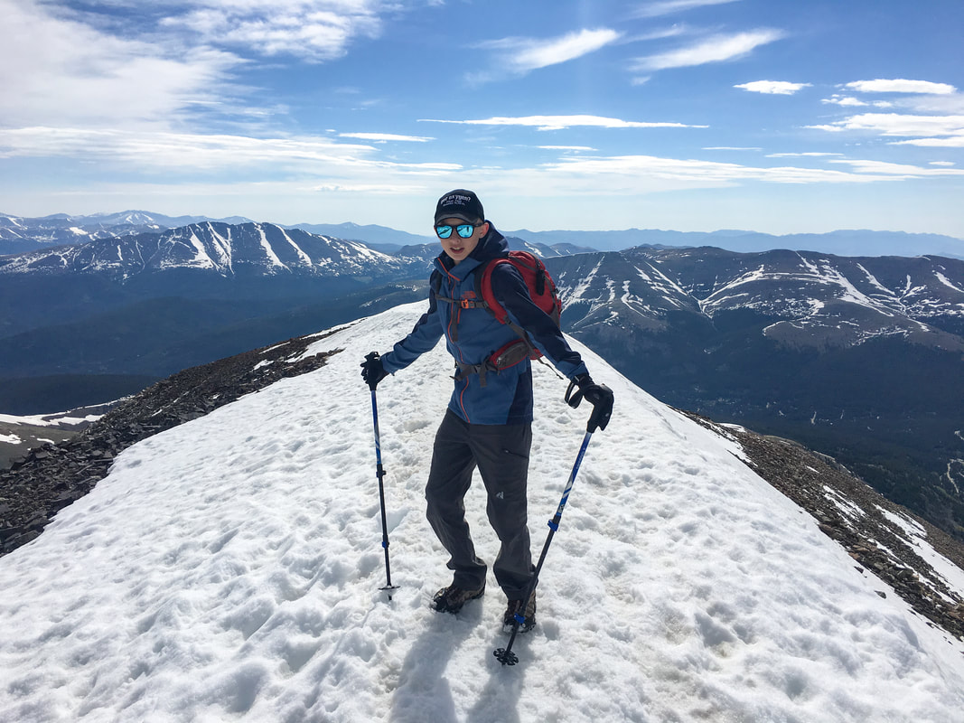
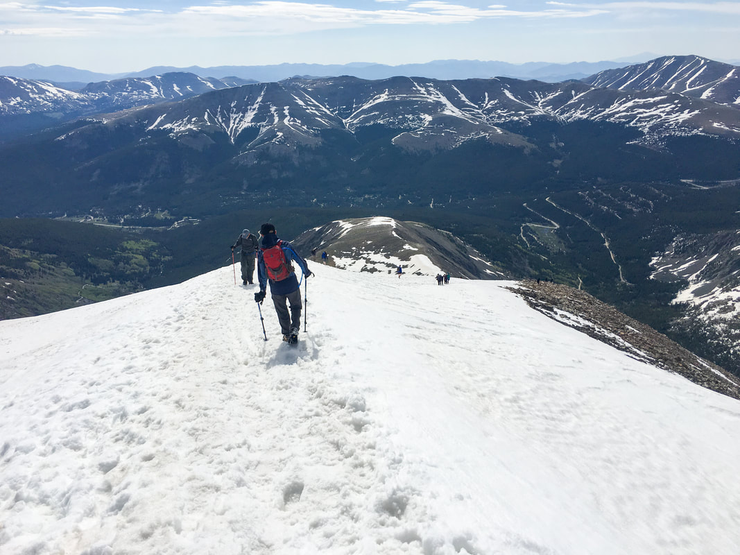
In a testimony to how overrun Colorado has become, you now need a reservation to park at the trailhead or you have to ride the shuttle from Breckenridge to the trailhead. Fortunately, last time we did this hike, we did it in June, which was magnificent. Everything I dislike about 14ers was covered in hard pack snow (or at least there was option for snow instead of rocks). The ascent is still a nice cardio workout, but the descent is easy, fun, and fast. You can either glissade back down, sled, or ski (if you feel like bring skis with you). When we went it was snowpack from treelike to the summit, no rocks, no scree: how marvelous.
|
quandary peak
getting there:
Address:
1) From Colorado Springs, there are really two ways to get here. We tend to go the back way by heading up through Woodland Park, passing through Divide, then Florescent, Lake George, and Hartsel. You can also go the I-70 way if you like traffic.
2) Take a right on Route 9 toward Fairplay
3) At 285, take a right toward FairPlay, then take a left onto Route 9 again toward Alma and Breckenridge.
4) Once you pass over Hoosier pass, you will wind your way down toward Blue River.
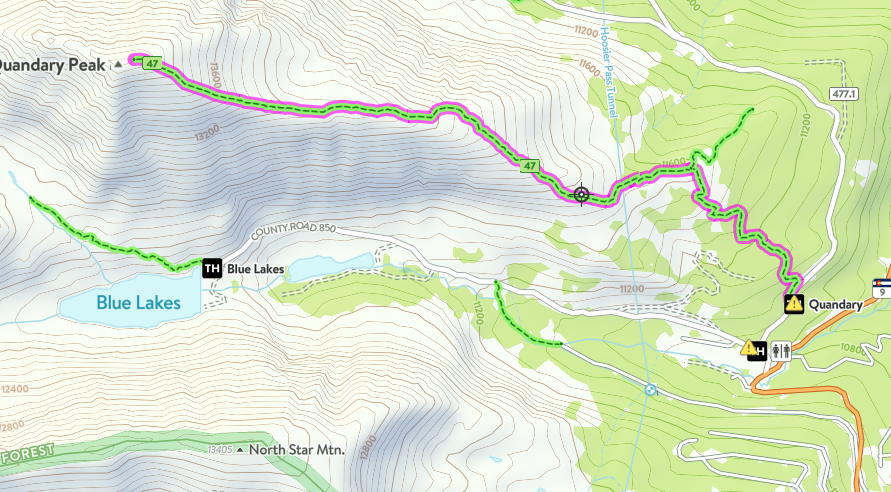
5) As you get to the bottom of the switchbacks, you will see the trailhead off to the left off of County Road 850 (Blue Lakes Road). There are two parking areas. The one by Route 9 is visible from the road, and I once saw a Moose here. The other parking area is a little further up the road to the right (McCullough Gulch Road) or county road 851. McCullough gulch is a great hike too, and so this area is unbearably over crowded on a summer weekend. Try to come up here during the week in the Spring or early Fall when the Denverites are still hibernating or deep into their pumpkin spice lattes.
1) From Colorado Springs, there are really two ways to get here. We tend to go the back way by heading up through Woodland Park, passing through Divide, then Florescent, Lake George, and Hartsel. You can also go the I-70 way if you like traffic.
2) Take a right on Route 9 toward Fairplay
3) At 285, take a right toward FairPlay, then take a left onto Route 9 again toward Alma and Breckenridge.
4) Once you pass over Hoosier pass, you will wind your way down toward Blue River.
5) As you get to the bottom of the switchbacks, you will see the trailhead off to the left off of County Road 850 (Blue Lakes Road). There are two parking areas. The one by Route 9 is visible from the road, and I once saw a Moose here. The other parking area is a little further up the road to the right (McCullough Gulch Road) or county road 851. McCullough gulch is a great hike too, and so this area is unbearably over crowded on a summer weekend. Try to come up here during the week in the Spring or early Fall when the Denverites are still hibernating or deep into their pumpkin spice lattes.
The Hike:
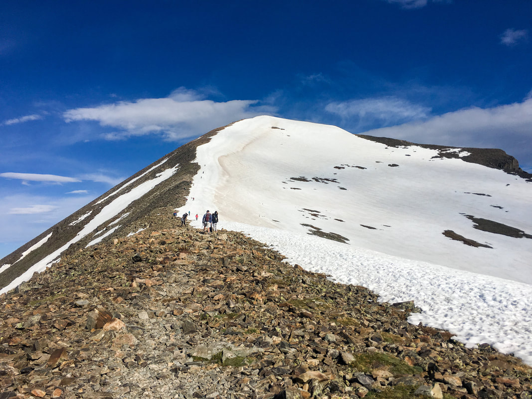
From McCullough Gulch Road, the trail will be marked off to the left. This is a great meander through the forest and cool in the early morning. Hopefully, the moronic pot smokers won't have stunk up the forest and you can enjoy the smell of pine trees as you make your way through the forest into a clearing. Continue through the clearing and around 11,600 feet you will gain east ridge. Wander across the flat area and start your way up.
From here, you will follow the east ridge pretty much to the summit. You will hit some flat areas along the way, and then the last 1,000 feet you will head straight up to the top. As long as you stay on the ridge, you will stay away from any potential hazards.
From here, you will follow the east ridge pretty much to the summit. You will hit some flat areas along the way, and then the last 1,000 feet you will head straight up to the top. As long as you stay on the ridge, you will stay away from any potential hazards.
|
|
|
|